Our Technology
Integration is key.
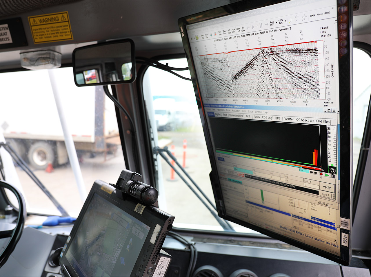
Acquisition Technology
Our Technology
- Proven oil and gas seismic hardware integrated with new shear wave technology for shallow profiling
- Real-time sub-meter accurate GPS location integrated with data recording
- State-of-the-art Vibroseis electronics monitoring of sweeps
- Three-component full wavefield receivers means MASW, SH AND P-wave data collection in a single pass
Our Competitive Edge - Acquisition
- High resolution imaging from surface to 200m
- Cost efficient Vibroseis energy source and land streamer, suitable for urban environments using minimal crew
- Non-intrusive - ideal for urban settings or dams and levees
- Rapid positioning and processing in the field to ensure data collection incorporates geological learnings in real-time
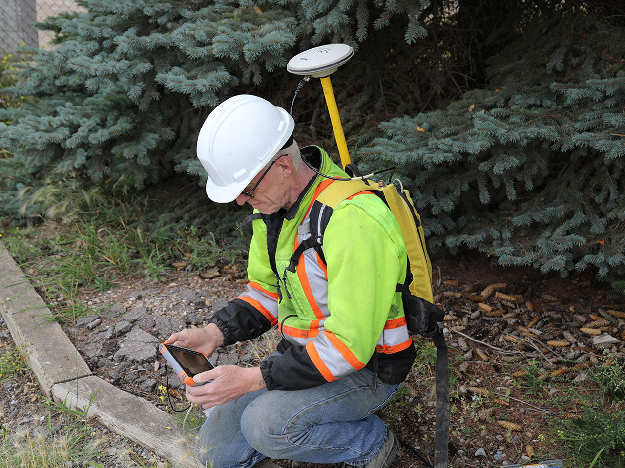
Survey Integration
Our Technology
- Realtime GPS with decimeter accuracy for timing, equipment positioning and data recording
- Integration with Vibroseis electronics
- Roving survey packs allow accurate positioning of our data recording and tying into key on-site engineering elements such as drill holes, surface infrastructure and/or hazards
Our Competitive Edge - Survey
- Improved accuracy in data and key element positioning means
- reduced amplification of errors in data processing
- avoid degradation of the final interpretation
- Real-time positioning allows rapid integration of geological learnings while in the field
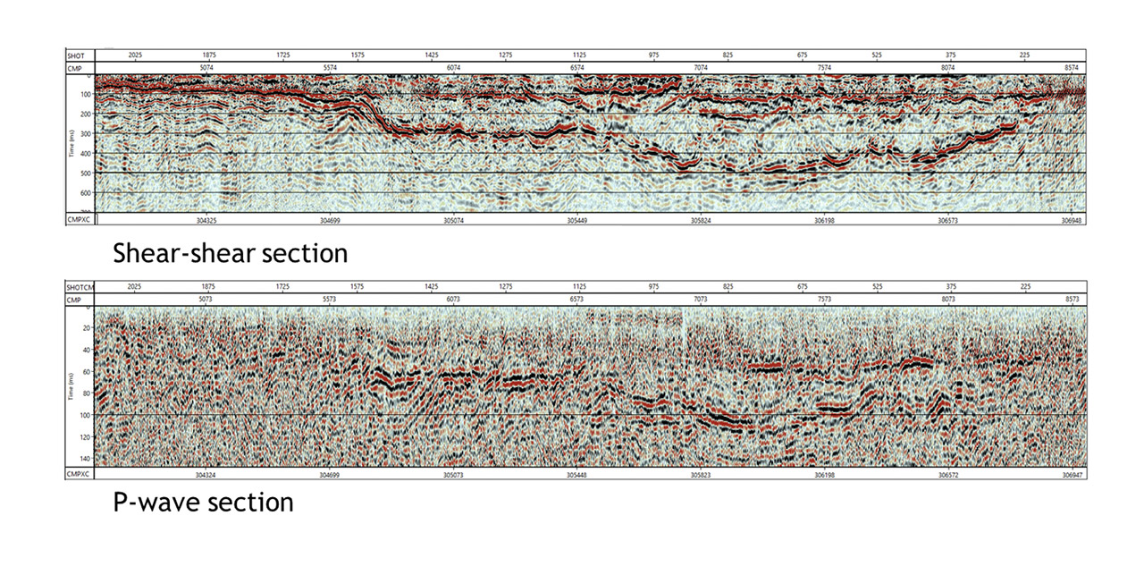
Processing Methodology
Our Methodology
- Adapt sophisticated oil Industry standard processing algorithms to near surface profiles
- Algorithms specifically designed to seamlessly manage the output data records from the newly developed land streamer
- Full wave form processing including Shear wave (MASW and SH-wave reflection) and Compression or P-wave data
Our Competitive Edge - Processing
- Rare depth of experience processing near surface reflection data as well as high resolution 3D oil industry data volumes
- Oil industry standard processing algorithms deliver superior results to simpler engineering processing software
- High resolution imaging in low velocity soils
- Shear modulus estimates delivered for engineering analysis
- Final results often available within 24 hours to enable important timely decisions in the field
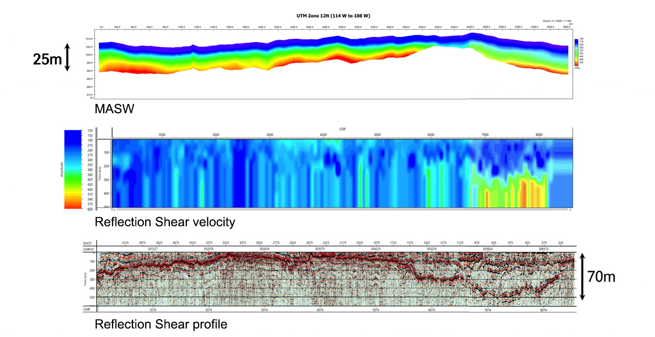
Interpretation Deliverables
Our Methodology and Deliverables
- Oil Industry standard seismic interpretation software has been modified for geotechnical applications
- Well spots, logs and soil types can be integrated with the seismic profiles to tie the profiles to drill or CPT locations.
- Horizons or lithologic boundaries are interactively “picked” along the profiles and can be exported as ASCII or excel databases.
- Seismic times can be converted to depth and contours can be generated for each layer that tie the drill logs.
- Velocity sections are generated and overlaid on the seismic profiles to identify layer characteristics
Our Competitive Edge - Interpretation
- Oil industry standard deliverables ready for integration to geotechnical workflows including:
- Stratigraphic and structural profiles validated with available well and CPT data
- Lithologic horizons ready for integration with other engineering datasets
- Velocity sections overlain on seismic profiles for geotechnical or hydrogeological modeling
- Estimates of engineering parameters such as shear modulus
- Quickly identify subsurface features such as tunnels, fluids, low shear strength materials and buried channels.